Back to products
#etrex10
- All products
- Uncategorized0 products
 Art Supplies397 products
 Art Resins & Molds13 products
 Brushes & Painting Tools41 products
 Canvas & Easels17 products
 Cutting Tools12 products
 Inks9 products
 Mediums & Varnishes40 products
 Paints75 products
- Automatic Level2 products
- Bundles0 products
 Drawing & Illustration257 products
 Office & School Supplies183 products
 Projectors0 products
 Surveying & Leveling Instruments20 products
- Uncategorized31 products
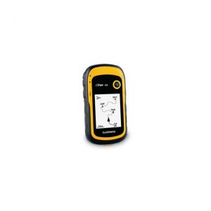
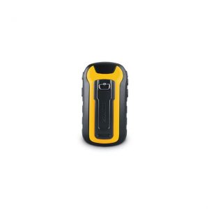
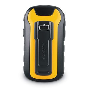
Garmin eTrex 10
See the Way eTrex 10 has an enhanced 2.2" monochrome display that’s easy to read in any lighting situation. Both durable and waterproof, eTrex 10 is built to withstand the elements. Its easy-to-use interface means you’ll spend more time enjoying the outdoors and less time searching for information. eTrex 10 features the legendary toughness that’s built to withstand the elements. Dust, dirt, humidity, water — none are a match for this navigator. Find Fun eTrex 10 supports geocaching GPX files for transferring geocaches. Visit OpenCaching to start your geocaching adventure. By going paperless, you're not only helping the environment but also improving efficiency. eTrex 10 stores and displays key information, including location, terrain, difficulty, hints and descriptions, which means no more manually entering coordinates and paper print outs. Simply upload the GPX file to your eTrex 10 and start hunting for caches. Keep Your Fix With its high-sensitivity, WAAS-enabled GPS receiver and HotFix® satellite prediction, eTrex 10 locates your position quickly and precisely and maintains its GPS location even in heavy cover and deep canyons. Whether you’re in deep woods or just near tall buildings and trees, you can count on eTrex 10 to help you find your way when you need it the most. Go Global eTrex devices are the first-ever consumer-grade receivers that can track both GPS and GLONASS satellites simultaneously. When using GLONASS satellites, the time it takes for the receiver to “lock on” to a position is (on average) approximately 20 percent faster than using GPS. And when using both GPS and GLONASS, the receiver has the ability to lock on to 24 more satellites than using GPS alone. Plan Your Next Trip With BaseCamp™ you'll be able to view and organize your maps, waypoints, routes, and tracks and send them to your device. It displays topgraphic map data in 2-D or 3-D on your computer, including contour lines and elevation profiles. It also can transfer an unlimited amount of satellite images when paired with a BirdsEye Satellite Imagery subscription, as well as geotag photos and associate them with specific waypoints.